Call WhatsApp Enquire
Aerial Operations

Aerial Work & Survey Services

Specialised helicopter aerial work, laser air survey, aerial photography, power-line and pipeline inspection, advertising and load lifting, with trusted, permit-holding operators.
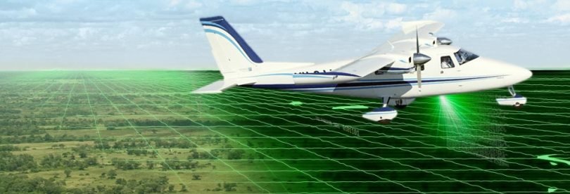
Laser SurveyLiDAR
Permit-HoldingOperators
Written QuoteAlways
Aerial work and helicopter survey services
Aerial Operations Aerial Laser Air Survey
Helicopter Aerial Work

Aerial Work & Survey Services

BookHelicopter.com arranges a full range of aerial work helicopter services, including aerial laser air survey, aerial photography and filming, power-line and pipeline inspection, aerial advertising and external load lifting. Tell us your requirement and we will connect you with trusted, permit-holding operators flown by experienced pilots.

Industrial Drone Survey

Drone survey, inspection and aerial mapping of plants, mines, warehouses and industrial infrastructure: maps, stockpile volumes and thermal scans.

View Details
Aerial Laser Air Survey

Helicopter Aerial Work & Survey Operations

BookHelicopter.com arranges aerial work helicopter services including aerial laser air survey and other specialised charter operations. Get in touch with us with your requirements and we will connect you with trusted, permit-holding operators. Share the survey area, scope of work and timeline, and our team will get back to you with the best available aircraft and a clear written quote.

Get a Quote

Helicopter, plane or drone: which suits the job

  • Helicopter: slow, low flight along a winding route, following the terrain in the hills. It suits long corridors such as power lines, pipelines, roads and railways, mountain projects, lifting loads to sites without a road, and air advertisement over a city or an event.
  • Fixed-wing aircraft: suits large, open survey blocks flown in straight lines.
  • Drone: suits a single plant, mine, warehouse or construction site of a few square kilometres, and is usually faster and costs less there. See industrial drone survey.

For terrain under forest or scrub, aerial LiDAR survey from a helicopter can separate bare earth from vegetation, which photo-based mapping cannot.

How an aerial work job is booked

  • Requirement. You send the area or route (a KML or shapefile is ideal), the scope of work, the outputs and accuracy you need, and the deadline.
  • Feasibility. The operator looks at the aircraft and equipment needed, where it would be based, and the clearances the area needs.
  • Permissions. Survey flights need airspace clearance, some areas need security clearance for aerial survey, and advertising flights need permission for the route. Allow several weeks.
  • Written quote. You see the full cost before anything is booked.
  • Flying. Sorties fly in daylight and fair weather. Mountain work is planned around the season, because cloud and rain stop a sortie.

What decides the cost

  • Flying hours, including positioning from the operator's base to the work area and back.
  • The size of the area or the length of the route, and how many sorties it takes.
  • The equipment: LiDAR, cameras, sensors, a sling for external loads, or a banner.
  • Processing and deliverables for survey work: point clouds, terrain models, maps or reports.
  • Permissions, landing and night-halt charges, where they apply.

What to check before you pay

  • Which permit-holding operator will fly, and which aircraft and equipment are planned.
  • Who arranges each clearance, and how long each is expected to take.
  • That the quote is all-inclusive: positioning, flying, equipment, processing, permissions and taxes.
  • What happens to the schedule and the cost if weather or a clearance stops a sortie.

For aerial filming, see helicopter for film shooting; for passenger or cargo flights on your own route, see private helicopter charter.

Quick Quote

Booking Enquiry

Share scope, area and dates for your aerial work operation. We reply with availability and next steps.

Tell us your aerial work details

Fields marked * are required. Your details are used only to respond to your enquiry.

Questions

Aerial Work & Survey Helicopter Services, FAQs

What aerial work services can be arranged by helicopter?
Aerial laser (LiDAR) survey, aerial photography and filming, power-line and pipeline inspection, aerial advertising, geophysical and magnetic survey, external load and sling lifting, crop and aerial spraying, and search and rescue support, as well as industrial drone survey.
Who flies aerial work and survey operations?
BookHelicopter.com arranges the work and connects you with trusted, permit-holding operators flown by experienced pilots.
What details do I need to send for an aerial work quote?
Share the survey area, scope of work and timeline. For a survey, a KML or shapefile of the area or route, the deliverables and accuracy you need and your deadline help. You get a clear written quote before anything is booked.
How far ahead should an aerial survey or advertising flight be booked?
Usually several weeks. Survey flights need airspace clearance, some areas need security clearance for aerial survey, and advertising flights need permissions for the route; mountain surveys are also planned around the season.
What does aerial work cost?
It depends on the type of job, the area or route, the flying time, the outputs you need and the permissions involved. Send your requirement and you get a written quote before anything is booked.
Should I use a helicopter or a drone for a survey?
For long corridors such as power lines, pipelines, railways and highways, a helicopter with airborne LiDAR covers the distance in one sortie. For a single plant, mine or construction site, a drone survey is usually faster and costs less.

Related journeys

Other ways to fly the same route, and the packages people compare it with.

Before you book, read

Plain answers to what people ask about this trip.

Plan your trip: Helicopter services in IndiaHelicopter service in UttarakhandHelicopter service in DehradunBooking FAQsHow booking works